GIS-GEOLab Projects

Projects Presentation
Projects List
AQpictures (2025)
The Air Quality from pictures: benchmarking and assessment of image-based methods for Particulate Matter estimation (AQpictures) project, funded by the ISPRS Scientific Initiatives 2025 programme, focuses on advancing complementary approaches to air quality monitoring by assessing and implementing methods based on webcam and mobile outdoor photos. As part of the project's outcomes, an open scientific toolkit , including code, sample datasets, and documentation, has been released to support implementation and replication across different geographic contexts.
Analysis of Local Climate Zones and Urban Heat Island using Geomatic Techniques (LCZ-UHI-GEO) (2024-2026)
The project “Analysis of Local Climate Zones and Urban Heat Island using Geomatic Techniques” (LCZ-UHI-GEO) is funded by the Italian Ministry of Foreign Affairs and International Cooperation (MAECI) and the Department of International Cooperation of the Ministry of Science and Technology of Vietnam (MOST). It involves the participation of Politecnico di Milano, the Italian Space Agency (ASI) and the Vietnam National Space Center (VNSC). It aims to replicate and expand the methodologies developed in the project LCZ-ODC and to test them, in a comparative manner, on cities in Italy and Vietnam. The selected cities are Milan and Rome in Italy, and Hanoi and Ho Chi Minh City in Vietnam. The bilateral collaboration will enable the study of diverse urban climatic contexts. Leveraging the integration of various areas of expertise, the project will advance research on the correlation between LCZ maps and temperature maps generated from in situ and satellite data.
SIU (2024-2027)

The Space It Up project, funded by the Italian Space Agency (ASI) and the Ministry of University and Research (MUR), brings together Italian expertise in space science and engineering. GIS-GEOLab is involved in Spoke 7 "Space for the sustainable development of the planet", leading the Work Package 7.4 "Zero emission society". In particular, the research activities focuse on developing innovative methods for monitoring air pollutants and emission sources in urban areas, and advanced techniques to study urban heat islands, local climate zones using Earth Observation data.
SURE (2024-2025)
The SURE (Smart Urban Resilience Enhancement) project, funded by the European Space Agency (ESA) EARLY DTCS DEVELOPMENT ACTIONS programme, focuses on advancing urban resilience by tackling the challenges of Urban Heat Islands (UHI) and urban flooding. Leveraging geospatial Digital Twin technology, SURE combines Earth Observation data and advanced simulations to implement prototype dynamic urban environment models. These tools will showcase how to analyze "what-if" scenarios to stakeholders, enabling data-driven decisions for sustainable urban planning and climate adaptation, emphasizing mitigating heat stress and enhancing flood resilience in cities like Milan (Italy) and Luxembourg.
GLANCE (2024-2026)
The GLANCE project, funded by the European Space Agency (ESA), aims at quantifying changes in forest extent due to agricultural land abandonment in the Mediterranean region and their effects on water and carbon cycles. GLANCE will use a combination of advanced analytical methods applied to long time series of Essential Climate Variables (ECVs) from the ESA CCI database to understand the interactions between forest expansion, water cycles, and climate change by investing the fit-for-purpose of such data for large-scale hydrological modeling.
CCI+ HRLC Phase-2 (2024-2027)
The Climate Change Initiative – High Resolution Land Cover Phase-2, funded by ESA following the successful conclusion of Phase-1, builds on the lessons learned during the first phase and aims to produce various land cover maps at different spatial resolutions. The project will generate static land cover maps for selected regions at 10m resolution for a predefined year, historical land cover maps for subregions within each main area at 30m resolution every five years from 1990 to the present, and annual land cover change maps at 30m resolution for specific land cover changes. It focuses on sub-continental areas in Africa, South America, and Siberia, representing diverse ecosystems and climatic conditions. GEOLab is part of the validation team, performing inter-comparisons between the project’s outputs and existing land cover maps.
Copernicus4schools (2023-2025)
PoliMI participates in Copernicus 4 Schools through a Collaboration Agreement with ISPRA. Copernicus 4 Schools (full name: "Copernicus 4 Schools - The Great Disaster Challenge") is part of the Work Programme 2020 of the Framework Partnership Agreement on Copernicus User Uptake (FPCUP) - Tier 2 - Specific Grant Agreement No. 20-2022/SI2.879178-SI2.879180/20, action No. 2021-2-08. The coordinator, on the Italian side, is, as for all these actions, ISPRA.
The overall objective is to inspire pupils and teachers to use and better understand the Copernicus programme and the possibilities of Earth Observation. Understanding how to use satellite images in the classroom for monitoring our planet will be valuable for daily teaching and to complement many learning objectives. This will be done in a joint European effort, inviting pupils from secondary school (age approx. 13-16) to participate in a Great Disaster Challenge, that will take place simultaneously across Europe after appropriate training. It will be a collaborative task, rather than a competition, where secondary school classes around Europe will work both on their own and in international teams to react to a “real life” disaster like floods.
GeoAIr - Geo-Intelligence for improved air quality monitoring and analysis (2023)
Project of National Interest (PRIN) funded by the Italian Ministry of University and Research (MUR). GeoAIr aims to employ geomatic techniques and geo-based artificial intelligence for air quality modelling by integrating open EO data with observations from traditional air quality monitoring networks and low-cost IoT sensors. Results will be accessible through innovative geo-visualization tools utilizing XR (extended reality) solutions.
UDENE - Urban Development Explorations using Natural Experiments (2023-2025)
Funded by the Horizon programme, under the HORIZON-EUSPA-2022-SPACE call, the UDENE Project aims to use large amounts of Earth Observation (EO) data from Copernicus satellites and local sources to support evidence-based decision-making for urban development, especially in international partner countries. It seeks to address the challenges posed by increasing urbanization driven by factors like climate change, inequality, and conflict. The project plans to create a virtual laboratory for urban planners and visionaries to test their development ideas. Multi-dimensional models of urban areas across time and countries will be used to support urban planners in exploring natural occurrences of similar development ideas, concepts, or projects in similar urban areas (natural experiments). Project outcomes will be embodied by an exploration tool for natural experiments and a match-making tool which will leverage the exploration tool by linking the existing EO product, process, or service offerings.
ASI I4DP - Science - Local Climate Zones & Open Data Cube (LCZ - ODC)
The Local Climate Zones & Open Data Cube (LCZ - ODC) project is
funded by ASI in the context of the "Sustainable Cities" of the
ASI Innovation for Downstream Preparation for Science
(I4DP_SCIENCE) program and it is developed in collaboration with
Politecnico di Milano. The project aims to identify the Local
Climate Zones (LCZ) and study their correlation with air
temperature in the Milan Metropolitan City through the integration
of geospatial data and Earth Observation technologies in the Open
Data Cube (LCZ-ODC) environment.
The LCZ maps will be identified using a combination of high
spectral and spatial resolution satellite imagery, including
PRISMA hyperspectral and Sentinel-2 multispectral imagery, as well
as regional geospatial data provided by local authorities.
As part of the project, interactive and innovative applications
will be developed to enhance the accessibility of the LCZ maps and
enable national users to effectively utilize the project's
products. The project outcomes will be presented to users through
workshops and events, which will provide an opportunity to collect
feedback and consolidate requirements for the developed
applications.
CADEO - Climate change Adaptation using Digital geospatial twins and Earth Observation (2022-2025)
The Climate change Adaptation using Digital geospatial twins and Earth Observation (CADEO) project for Capacity Building in Higher Education in Vietnam is funded by Erasmus+ Programme of the European Commission under the action CBHE 2022 . The consortium includes two EU Higher Education Institutions (Politecnico di Milano, IT and Lund University, SE), four Vietnamese HEIs (Hanoi University of Mining andGeology, Hue University, Vietnamese-German University and Phenikaa University) and one Vietnamese privatecompany (VidaGis). Politecnico di Milano is the project coordinator. The project consists of designing, implementing, and blending teaching of four new innovative courses, training of trainers in HEIs of Vietnam, development of required digital infrastructure for Vietnamese HEIs, and dissemination of the results to wider society. Courses for higher education programmes focusing on: Earth Observation (EO), Digital Twin Earth, Geospatial Web applications and Geospatial Intelligence. Deployment of cutting-edge eLearning systems, co-designed by different EU and Vietnam HEIs and an industry partner with the participation of key stakeholders.
Capacity Building for GIS-based SDG Indicator Analysis with Global High-resolution Land Cover Datasets (2021)
The Capacity Building for GIS-based SDG Indicator Analysis with Global High-resolution Land Cover Datasets is a project funded by the Education and Capacity Building Initiatives of the International Society for Photogrammetry and Remote Sensing (ISPRS). The project addresses the creation of open training material (web-book and workshops) covering the complete learning process of discovering, accessing and manipulating global open geospatial datasets for computing SDG indicators, with a focus on those directly connected to marine and terrestrial ecosystems, urban environment, and climate. The (Training Material) leverages QGIS and it will be openly released.
Copernicus Coastal Web Viewer (2022)
The Copernicus Coastal Web Viewer is a web platform to visualize and analyze data from various Copernicus Services in conjunction with other data sources as a prototype of a Digital Twin of the Italian coast. It is a data integration platform that enables visualization and analysis using standardized services. More details at: CCWV
EUthmappers – open and collaborative mapping for pupils-led projects in Secondary Schools through innovative teaching methodology and fostering STEAM education and Environmental engagement (2022-2025)
EUthmappers is selected by Erasmus+ Programme of the European Commission under the action Cooperation partnerships in school education. The principal aim is promoting interest and excellence in science, technology, engineering, and mathematics (STEM) and the STEAM approach. The programme will contribute to increase the interest of Secondary Schools pupils in STEM matters and to enhance their digital skills and their environmental and civic engagement, by introducing them to the use of open-source geospatial tools finalized at the development of open collaborative and inclusive mapping projects based on OpenStreetMap platform (OSM). This process will lead pupils to enhance their digital skills for data analysis and processing, and to develop critical and spatial thinking and environmental contextualization analysis.
YouthMappers research fellowship project - Cross-continental YouthMapping for deforestation in Amazon (2020)
Cross-continental YouthMapping for deforestation in the Amazon region is a 2020 YouthMappers research fellowship. The main objective is to identify deforestation to help local authorities to forecast the possible spread of the deforestation and prevent them all in scope of preserving advantages that intact forest ecosystems provide, including regulating weather on local and regional scales, mitigating climate change, contributing to the conservation of biodiversity, improving air quality, and helping to preserve indigenous cultures. The deforestation is identified by applying Random Forest machine learning algorithm to the Sentinel-2 imagery in 2019 and 2020, and by computing land cover changes. Training and validation data for Random Forest were collected in the OSM database during a mapathon organized as a part of Collaborative and Humanitarian Mapping Passion in Action Course. Data processing and deforestation detection was done on GoogleEarthEngine.
D-DUST - Data-driven moDelling of particUlate with Satellite Technology aid (2021-2023)

The D-DUST project, funded by Fondazione Cariplo, focuses on the development of new means to improve both understanding and local monitoring of farming-related Particulate Matter (PM) emissions. The aim of D-DUST is to assess the contribution deriving by the systematic integration of non-conventional data, with a focus on satellite-based PM estimates, into traditional PM monitoring frameworks based on fixed ground sensors. Data ingestion to support traditional PM monitoring and modelling will take the best advantage of data science techniques through the combination of machine-learning and geostatistical models. The final ambition is to foster debate and awareness among regional policymakers, farming operators, and citizens on both technical and non-technical aspects for co-creating best evidence-based practices targeting the reduction of emissions from the farming sector.
HARMONIA - Development of a Support System for Improved Resilience and Sustainable Urban areas to cope with Climate Change and Extreme Events based on GEOSS and Advanced Modelling Tools (2021-2024)
HARMONIA aims at leveraging existing tools, services and novel technologies to deliver an integrated resilience assessment platform working on top of GEOSS, seeing the current lack of a dedicated process of understanding and quantifying Climate Change effects on urban areas using Satellite and auxiliary data available on GEOSS, DIAS, urban TEP, GEP etc. platforms. HARMONIA will test modern Remote Sensing tools and 3D-4D monitoring, Machine Learning/Deep Learning techniques and develop a modular scalable data-driven multi-layer urban areas observation information knowledge base, using Satellite data time series, spatial information and auxiliary data, in-situ observing systems, which will integrate detailed information on local level of neighborhoods/building blocks. HARMONIA will take into account the local ecosystems of European urban areas, following an integrated and sustainable approach by incorporating the active communities’ participation initiative, which will involve the use of a social platform.
GIS4SCHOOLS - Improving STEAM Education in Secondary Schools through the development and co-creation of new methodologies for teaching to and exploitation by pupils of GIS products related to climate impact on the environment (2020-2023)

GIS4Schools aims at promoting a new innovative approach to foster the teaching of STEAM subjects in secondary schools. This objective will be achieved by allowing pupils to learn about GIS and Remote Sensing and abouy how to use data and tools to respond to climate change challenges. The data will be provided by the European Earth Observation Programme Copernicus and will be used to help the pupils in the co-creation process of GIS-based products. A training has been dedicated to the School teachers and a training package has been developed to support them in training the pupils. The students will work on projects based on the learned tools on disaster, risk analysis and climate change, then thay will share their workwith students from developing countries.
GEOLMIV - Geoinformatics and Earth Observation for Landslide Monitoring. (2021–2023)
A joint project between Politecnico di Milano, Italy and Hanoi University of Natural Resources and Environment, Vietnam. The project is funded on the Italian side by the Ministry of Foreign Affairs and International Cooperation (MAE). The project is focused on the problem related to landslides phenomenon which is relevant in both Italy and Vietnam. The goal is to join efforts and experience in the field of geodata science, focusing on the most innovative approaches. Where the partners will design and implement sustainable new observation processing strategies. As such to study and apply new techniques for landslide detection and monitoring through earth observation data, machine learning algorithms and citizen science .The project will have an important consequence also in building new capacities, which will be transferred into the universities’ teachings and professional refresher training, with a direct impact on students and an indirect influence on technology transfer outside the academic environment.
CIDMA - Climate Change Induced Disaster Management in Africa. (2019-2022)
Selected by Erasmus+ Programme of the European Commission under the action Capacity Building in the field of Higher Education 2019.The main aim of CIDMA is to build education capacity to improve disaster management in Mozambique, using geospatial information technology. It focuses on spatial data and methods, using digital maps, satellite data, and spatial modelling, in order to foresee and prepare for risks related to possible disasters linked to a changing climate. The objectives are to develop up-to-date courses in disaster management; train partner members on how to develop and teach the courses; implement the developed courses at the partner universities in Mozambique; improve quality in education and teaching; improve infra-structure at the partner universities in Mozambique; develop and implement a Disaster Management Tool; disseminate outputs and outcomes, and to develop Higher Educational Institutions within society. The consortium is composed of eight partner institutions from – Sweden, Portugal, Italy and Mozambique. GEOLab is responsible for developing the “Public Participatory GIS and Spatial Data Infrastructure in Disaster Management” course.
SIMILE (2019-2022)

SIMILE (Informative System for the Integrated Monitoring of Insubric Lakes and their Ecosystems) is a recently started three years project financed by the Interreg Italy-Switzerland 2014-2021 program. It involves partners from the scientific and technical sector (Politecnico di Milano – Lecco Campus; Fondazione Politecnico; Water Research Institute - National Research Council; SUPSI - University of Applied Sciences and Arts of; Southern Switzerland) and from the institutional sector (Lombardy Region; Ticino Canton) working in synergy. The main project goal is the protection of water quality for Lugano, Maggiore and Como lakes through a geoinformatic coordination of existing monitoring systems with new data collection methods. Images from European Space Agency (ESA) Sentinels will be integrated with high frequency sensors, placed on buoys and floating platforms, and Volunteered Geographic Information (VGI) produced with a Citizen Science approach.
INSUBRI.PARKS (2019-2022)

Funded under the INTERREG Cross-border Cooperation Operational Programme Italy-Switzerland 2014 - 2020 (ID 605472), the project aims at increasing the attractiveness of the Lombardy Region (IT) and Canton Ticino (CH) natural parks through the development of new thematic itineraries, infrastructural interventions, and the application of cutting-edge open IT technologies for promotion and monitoring of the tourism activities in the area.
CCI+ HRLC (2018-2021)
Climate Change Initiative – High Resolution Land Cover is a project funded by ESA. It is aiming at producing high-resolution land cover map to support climate modelling at regional scale. Sub-Saharan Africa, Siberia and Amazonia are the three regions selected for mapping. The outputs of the project are multiple: static land cover for each selected region at 10m spatial resolution for year 2018, historical land cover map for selected subregion in each main region at 30m resolution for every 5 years starting from 1990 until present date, and land cover change maps for specific land cover change at 30m spatial resolution on a yearly scale. GEOLab is part of Validation team and carries out inter-comparison of the project outputs with existing land cover maps.
GIOCOnDA (2019-2021)

GIOCOnDA (Gestione Integrata e Olistica del Ciclo di vita degli Open Data – “Integrated and Holistic Management of the Open Data Cycle”) is a project is supported by the Interreg Italy-Switzerland 2014-2020 programme. The main goal for the project is to strengthen the coordination capacity for the public administrations on the practices for the open-data publication and sharing. In addition, it searches to identify the needs of stakeholders and the public at the cross-border to provide adequate resources to enhance their decision-making processes, and therefore the socio-economic development in the region. Open Government Data sources, such as dati.lombardia.it and opendata.swiss, will serve as a basis for the creation of a common platform. Pursuing the goal of interoperability, the datasets are meant to be published under shared open standards and framework. When possible, the datasets will be enriched with geospatial components considering the integration of datasets.
ViaLibera?! (2018-2021)
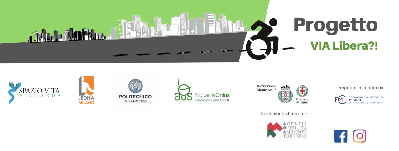
Founded by Fondazione di Comunità Milano Onlus. The project, which started in October 2018, foresees the verification and mapping of the accessibility of three areas of Municipality 9 in Milan. The objective is to define a model of intervention that can also be exported to the other Municipalities of Milan and to other cities, which foresees the use of freely available or at least low cost, open-source technologies and the active involvement of citizens, in order to develop a shared culture of accessibility as a good for all. The partners of the project are Spazio Vita Niguarda Onlus, Ledha Milano, Politecnico di Milano and AUS Niguarda Onlus with the participation of Municipality 9 and AMAT.
GEO4D (2017-2020)
GEO4D is a Capacity Building in Higher Education project, funded by the Erasmus+ Programme of the European Commission with the aim to modernize higher education in geodesy in order to support sustainable development in Jordan. The specific project's objective is to establish 3 new geodesy/GIS laboratories at 3 Jordanian partner universities during 2018, develop and start 3 new master programmes in autumn 2019 and introduce e-learning, Problem-Based Learning (PBL) and quality assurance in geodesy education during 2020.
Capacity Building for High-Resolution Land Cover Intercomparison and Validation (2018)
Funded as one of the ISPRS Education and Capacity Building Initiatives 2018, the project aims to create computer-aided teaching and learning material about the intercomparison/validation of global land cover maps and to organize three workshops, two of which are held in developing countries (Tanzania and Kenya). The training material for validation with QGIS can be downloaded here, the training material on how to use the Land Cover Collector application can be downloaded here, and the training material about how to use the GlobeLand30 Web platform can be downloaded here. The presentation on land cover maps and Sustainable Development Goals given at the workshops in Tanzania and Kenya can be found here. The slides of the presentation at FOSS4G 2018 can be downloaded here. Principal investigators are Politecnico di Milano and the National Geomatics Center of China. The development of the Land Cover Collector application was supported by Italian Ministry of Education, University and Research (MIUR) thanks to the URBAN GEO BIG DATA project.
Mapping the HYdrological Control ON shallOw landSliding (MHYCONOS) (2018-2020)
Funded by Fondazione Cariplo, the project aims to develop a robust and exportable methodology to investigate hydrological thresholds of shallow landslides triggering by gathering field and laboratory data on soil and hydrological parameters. An efficient GIS system will be created to store, handle and represent the main outputs of the project.
URBAN GEOmatics for Bulk Information Generation, Data Assessment and Technology Awareness (URBAN GEO BIG DATA) (2017-2020)
The project contributes to improving the exploitation of new data from EO and mobile sensors, for a better understanding of a number of urban dynamics. It will extract information from data, and represent it for better comprehension aiming at an improved public engagement. It is a Project of National Interest (PRIN) funded by the Italian Ministry of Education, University and Research (MIUR).
UN Open GIS (2016-2019)
UN Open GIS is an initiative to identify and develop an Open Source GIS bundle that meets the requirements of UN operations, taking full advantage of the expertise of a diverse partnership (partner nations, technology contributing countries, international organizations, academia, NGOs and the private sector).
ICARO - TraffIc effeCts on temperAture in the uRban envirOnment (2017)
The project is supported by the UN Global Pulse - Data for Climate Action Challenge. ICARO aims to investigate the influence of traffic events on local temperature within the City of Milan (Italy), by coupling ground sensors observations with satellite images and crowdsourced traffic data.
giCASES - Creating a University-Enterprise Alliance for a Spatially Enabled Society (2016-2018)

giCASES is a Knowledge Alliance project, co-funded by the Erasmus+ programme of the European Commission, with the objective of strengthening innovation between education and industry in the domain of in GI through the development of new learning material and processes based on case based learning and co-creation of knowledge.
EU COST Action CA15212 Citizen Science to promote creativity, scientific literacy, and innovation throughout Europe (2016-2020)
This EU COST Action aims to bundle capacities across Europe to investigate and extend the impact of the scientific, educational, policy, and civic outcomes of citizen science in order to gauge its potential as enabler of social innovation and socio-ecological transition.
MIGRATE - MIGRation pATterns in Europe (2016)
Funded under the third call of MYGEOSS Project by the Joint Research Center (JRC) of the European Commission, MIGRATE is a Web Mapping application developed with a gamification approach with the purpose of educating and raising awareness about the phenomenon of migration in Europe.
City Focus (2016)

City Focus, funded under the third call of MYGEOSS Project by the European Commission - Joint Research Center (JRC), is a web-based interactive 2D and 3D GIS application to find the best place in a city to live as well as to pass shorter staying.
EU COST Action TD1202 Mapping and the Citizen Sensor (2012-2016)

The overall aim of this EU COST Action is to increase the value of Volunteered Geographic Information (VGI) provided by citizen sensors for mapping applications, with a particular focus on map production and map evaluation.
EU COST Action IC1203 European Network Exploring Research into Geospatial Information Crowdsourcing: software and methodologies for harnessing geographic information from the crowd (ENERGIC) (2012-2016)
Focused on Volunteered Geographic Information (VGI), this EU COST Action gathers efforts carried out in the innovative and under-exploited field of Web research and knowledge production by establishing a European network of excellence on GeoWeb technologies.
The Paths of Regina - Crossborder Paths linked to Via Regina (2013-2015)
Funded under the INTERREG Cross-border Cooperation Operational Programme Italy-Switzerland 2007-2013, the project aims at the creation of new tools to promote cultural heritage in the crossborder area around the ancient Via Regina.